Products » GPS Area Measure Meter
LD-Agro GEO Mapper
Product details
Do you want to know the exact size of your agricultural area? Would you like to check the location of your landmarks, but do not want to spend a fortune on it? Does it take long for the land surveyor to arrive, and even then, the fees are high? Then, the LD-Agro GEO Mapper is made just for you.
| Area measurement accuracy | ~ 0,5-1% |
| Accuracy of point recording | <1,5 m |
| Correction signal | EGNOS |
| Coordinate systems | EOV, WGS84 |
| Satellite Signals | Free |
| GPS Receiver | Cable Connection |
| Google Earth | KML Format for Maps |
Do you want a practical, mobile and easy to use GPS survey instrument?
The GEO Mapper is a surveying software tested by NavCert. NavCert guarantees an accuracy below 1.5 m in case of point positioning with free EGNOS correction. (The German NavCert is certified by the TÜV, it is involved in the review and certification of GPS receivers), and in case of area measurement, the surveying GPS provides an accuracy within 0.5%. Measure accurately, wind up boundary disputes with your neighbours.
LD-Agro GEO Mapper, no more problems with surveying area sections
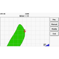
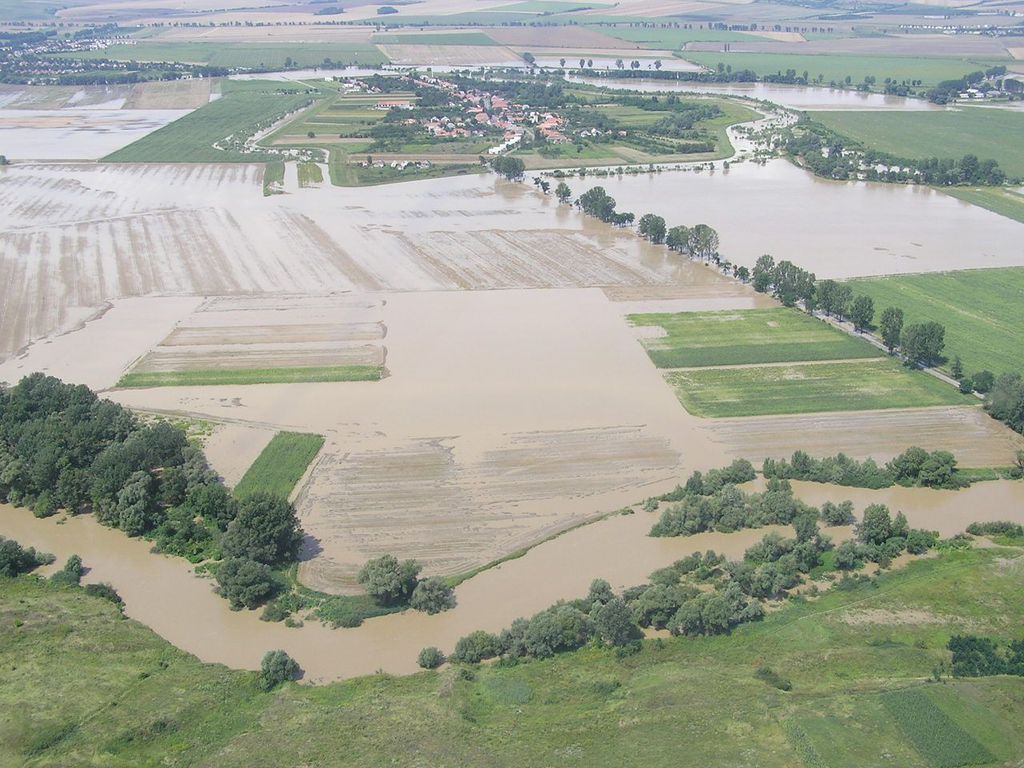 The software running on the GPS survey instrument can be excellently applied for the measurement of area sections. Brooding area, trench, row of trees or wildlife damage? Make your life easier by using the GPS survey instrument and survey the area sections to be measured simply and fast.
Bottomland area? If the weather shows no respect to you, at least make the best of it. When filing the compensation claim, the accuracy of the surveyed lands have utmost importance, as you will receive compensation based on that. You want to receive the appropriate amount from your insurance provider, don’t you? Do not let yourself be deprived of the due amount. The GEO Mapper area measurement tool is the best solution.
Do you want to provide the necessary quantities of different nutrients for your crops? Do you need to mark the points important for precision farming within your field?
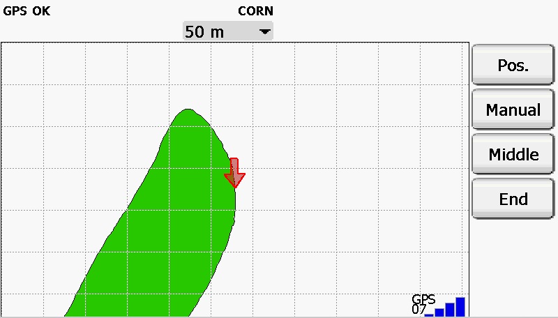 The area measurement tool can be a great help for you in this regard as well. The GEO Mapper GPS survey instrument will be your masterful helpmate in precision farming, and is highly appropriate for positioning as well. Prepare a release map through recording the soil sampling points, or mark the accurate coordinates of the landmarks, corner points, grid points, high water or weed growth points.
Has going around a fallen tree, ditch or stream ever caused headaches while surveying your field? The GEO Mapper area measurement tool can be a great help with that too.
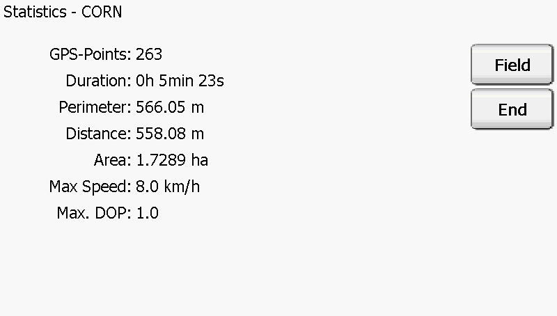 The land surveying can be paused on the LD-Agro GEO Mapper GPS survey instrument. If you need to go around an obstacle, which you cannot pass though, but which is included in the area, do not worry. Feel free to pause the measuring process. After going around the obstacle, you can continue the measuring where you left off, since the land surveying GPS- connects the last coordinates with the first new ones after going around the obstacle.
The GEO Mapper survey instrument is a great help in applying for area-based grants, submitting tender proposals.
When submitting applications and tenders, the accurate area measurement is indispensable, which is not a problem for the survey instrument.
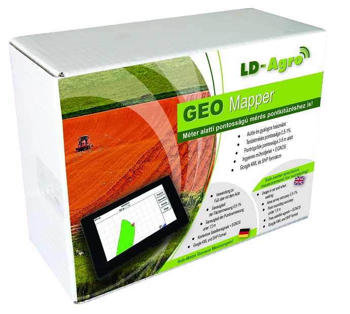 The key feature of the GPS survey instrument is its mobility.
The GEO Mapper is a surveying software tested by NavCert. NavCert guarantees an accuracy below 1.5 m in case of point positioning with free EGNOS correction. (The German NavCert is certified by the TÜV, it is involved in the review and certification of GPS receivers), and in case of area measurement, the surveying GPS provides an accuracy within 0.5%. Measure accurately, wind up boundary disputes with your neighbours.
GEO Mapper Parameters:
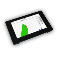
| Operation System | Microsoft Windows CE 6.0 |
| Size | 150x70x13 mm |
| CPU | MSB2531 ARM cortex A7, 800 MHz |
| Internal Memory | 4 GB Flash, 128 MB DDR |
| External Memory | 2-4 GB MicroSD |
| Display | 5 inch TFT LCD |
| Display Resolution | 800x480 pixel |
| Battery | Li-ion, 3.7V 1200 mAh |
| Wight | 198 gr |
| GeoX1 GPS Receiver | 1 Hz, GPS, GLONASS, EGNOS |
The accessories of GEO Mapper area measurement tool:
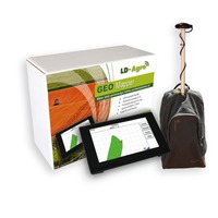
| - LD Agro GEO Mapper GPS survey instrument | - Land surveying software on SD card |
| - Car Charger | - USB synchronization cable |
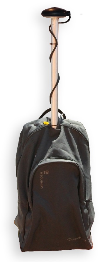
| - LD-Agro GeoX1 GPS backpack (with battery, GPS receiver, backpack, cables) | cables) - English software and English user manual |
Do you need an accurate, easy to use survey instrument, which helps you avoid boundary disputes? You too should buy the LD Agro GEO Mapper survey instrument, which is guaranteed to make farming easier.
- Home
- News
- Dealer Locator
- Meet with us
- Previous exhibitions
- Download
- About LD-Agro
- Contact
- Privacy policy
- Privacy statement
© 2024 LD-Agro Technologies Ltd. - All rights reserved. - ,,Professional GPS technology for agricultural use!“




 Office


