
Products » GPS Area Measure Meter
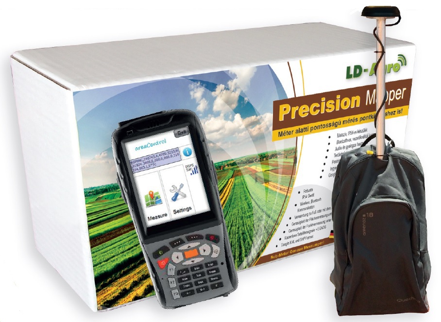
LD-Agro Precision Mapper

Product details
Do you have large quantities of leased land, is it made of small parcels, would you like to determine the location of soil sampling points accurately? LD-Agro Precision Mapper, fitted with an industrial PDA terminal, is always at your disposal when you need accurate data management.

| Area measurement accuracy | <0,5% |
| Accuracy of point recording | <1m |
| Correction signal | EGNOS |
| Coordinate systems | EOV, WGS84 |
| Satellite Signals | Free |
| GPS Receiver | Bluetooth |
| Google Earth | KML format for Maps |
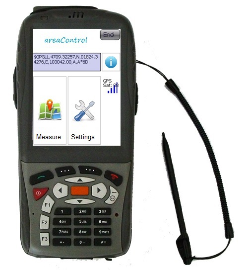
Easy to use, yet professional land surveying GPS: this is the LD-Agro Precision Mapper.
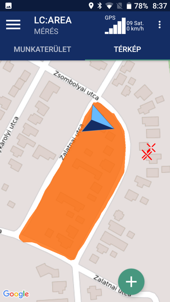 The Precision Mapper land surveying GPS is an excellent device at your service, which enables you to measure and determine land area, area sections, lines, and soil sampling points. The measured data can be managed in layers, can be supplemented with additional data, as well as organised into projects.
The software of the LD-Agro Precision Mapper is in English, the menu items are easy to understand, its use can be acquired quickly. Surveying is remarkably easy, you only have to either walk or drive along the area or line to be measured, and the surveying instrument will continuously record your path. The data can be copied from the Precision Mapper land surveying instrument to a computer via direct cable connection, in shape format.
How hard wearing is the handheld computer of the Precision Mapper land surveying instrument?
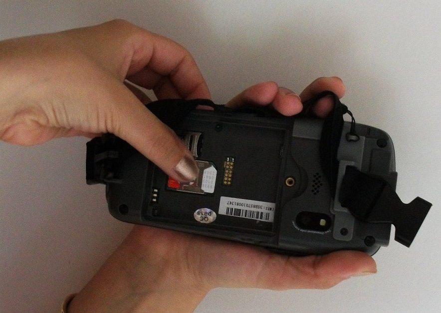
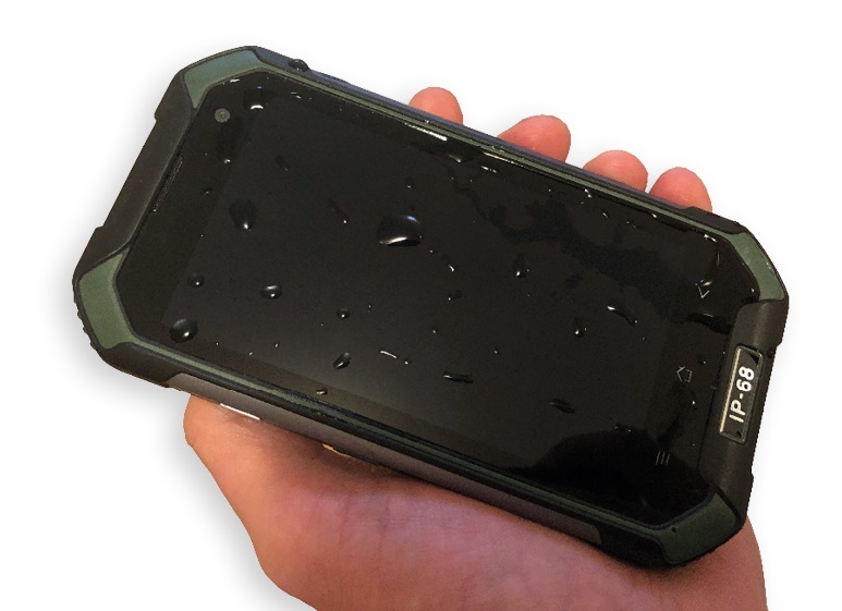 The land surveying instrument is distributed together with an industrial PDA. It has IP68 protection, which means that the land surveying handheld computer is completely protected against dust and splashing water.
It is remarkably fast with its 1.5 GHz quad-core processor, its 4-7 inch, high brightness display is well visible even in bright sunlight. Thanks to its battery, with and output of 4500 mAh, the Precision Mapper land surveying GPS can be used for 12 hours on one charge.
And this is not all! The land surveying GPS is equipped with a 8-megapixel camera and a SIM card slot, so can make phone calls as well.
Other useful features of the Precision Mapper
If you would like to put up a fence around your land, you can measure its circumference with the Precision Mapper with an accuracy of one meter. If your field incurs wildlife damage, you can just load the given field from the memory of the device and subtract the area sections from it. You will know within minutes and on-site, how large an area is damaged.
Precision Mapper Parameters:
| Operation System | Android 7.0 |
| Size | 81x152x17 mm |
|
CPU |
MT6737T ARM Cortext A53 1.5 GHz, Quad-core |
| GPU | Mali T720 |
| Camera | 8 Mpixel |
| Internal Memory | 2 GB RAM + 16 GB ROM |
| External Memory | 1~32 GB Micro SD Card |
| Display | 4,7 inch HD |
| Display Resolution | 720x1280 pixel |
| Communication | Bluetooth |
| Battery | Li-Polimer, 4500 mAh |
| Weight | 247 gr (battery included) |
| Impact Protection | IP68 |
| Backpack weight | about 3,25 kg |
| Backpack size | 25x75x22 cm |
| GeoX4 GPS Receiver | 4 Hz |
| GeoX4 GPS Receiver | GPS, GLONASS, EGNOS |
LD-Agro Precision Mapper land surveying instrument accessories:
| - LD-Agro Precision Mapper land surveying instrument | - USB synchronization cable |
| - 12V Car charger | - 230V charger |
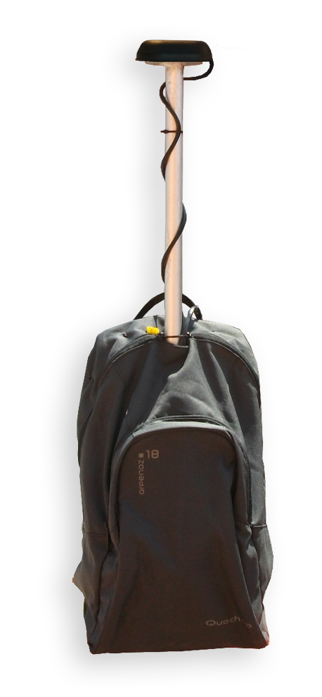
| - LD-Agro GeoX4 GPS backpack (battery, GPS receiver, backpack, cables) | - English-language software |
 Choose this versatile land surveying instrument, which stand out from the competition of other land surveying GPS devices with its extensive features and outstanding accuracy. With the LD-Agro Precision Mapper land surveying instrument, you can always manage the data of your fields in an up-to-date manner, which is essential in case of applying for area-based grants or assessing wildlife damage. In case of seasonal works, you can avoid disputes about the size of the field; the LD-Agro Precision Mapper always ensures precise measurements.


 Office


- Home
- News
- Dealer Locator
- Meet with us
- Previous exhibitions
- Download
- About LD-Agro
- Contact
- Privacy policy
- Privacy statement
© 2024 LD-Agro Technologies Ltd. - All rights reserved. - ,,Professional GPS technology for agricultural use!“